
E-mail: [email protected]


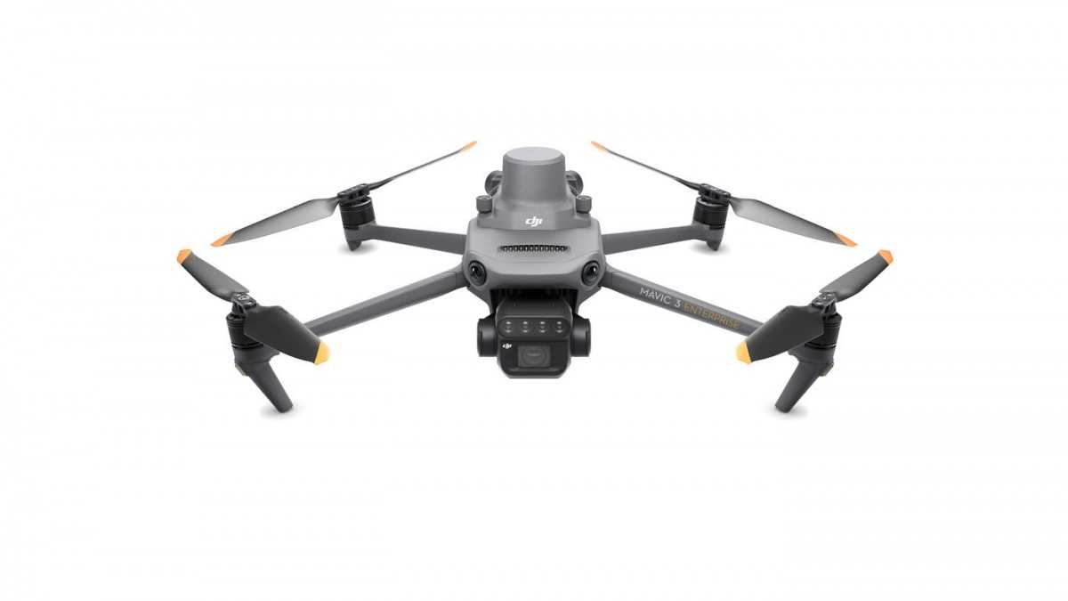
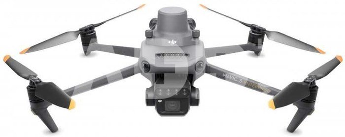
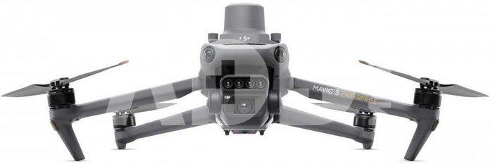
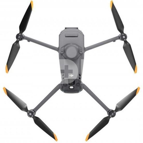
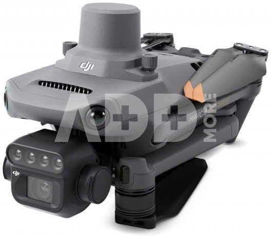
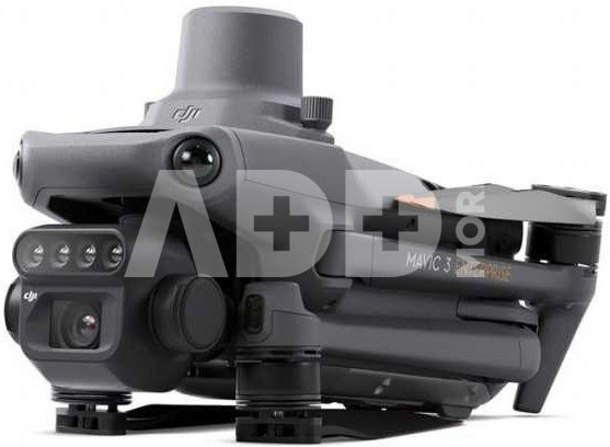
Meet the incredible DJI Mavic 3 Multispectral (also known as DJI Mavic 3M). This effective aerial surveying drone lets you sees the unseeable. Gain actionable insights with Crop health analytics, mapping and more. The Mavic 3 Miltispectral has two forms of sight- combining an RGB camera with a multispectral sensor to scan and analyze crop growth with high clarity.
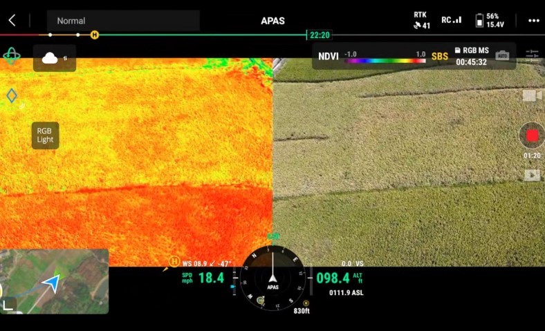
The built-in sunlight sensor captures solar irradiance and records it in an image file, allowing for light compensation of image data during 2D reconstruction. This results in more accurate NDVI results, as well as improved accuracy and consistency of data acquired over time.
DJI Mavic 3 Multispectral with RTK module for centimeter-level positioning. Flight control, the camera, and the RTK module sync in microseconds to accurately capture the location of each camera's imaging center. This enables Mavic 3M to do high-precision aerial surveying without using ground control points.
Ultra-long battery life, fast bursts. 43 minutes cruise time. A single flight can complete mapping operations over an area of 200 hectares.
The O3 transmission integrates two transmitting signals and four receiving signals to support 15km ultra-long transmission distances.
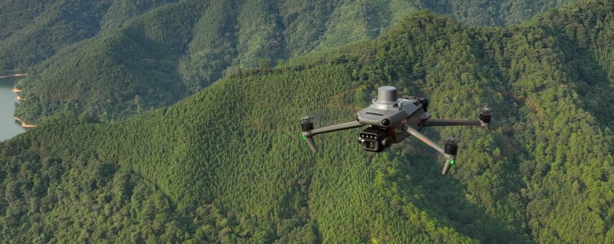
The aircraft features multiple wide-FOV vision sensors that accurately detect obstacles in all directions for omnidirectional obstacle avoidance. The terrain-follow aerial surveying can be easily performed in steep-slope landscapes.
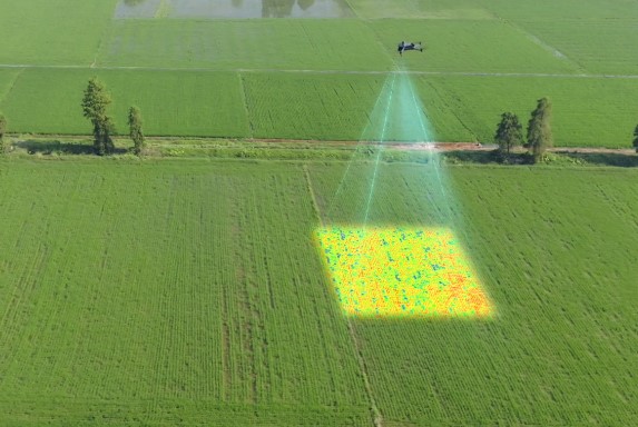
DJI Mavic 3M (Multispectral) allows terrain-follow aerial surveying of orchards, even on sloped landscapes. Together with DJI Terra or DJI SmartFarm Web to reconstruct high-resolution orchard maps, automatically identify the number of trees, distinguish trees from other obstacles or objects, and generate three-dimensional operation routes for agricultural drones, making operations safer and more efficient. For rice fertilization, cotton growth regulation, and potato foliar fertilizer spraying, the DJI Mavic 3M (Multispectral) is used to obtain multi-spectral images of crops. DJI Terra or the DJI SmartFarm Web can then generate NDVI and other vegetation indices maps, capturing differences in crop potential and generating prescription maps that allow agricultural drones to execute variable-rate application. This ultimately allows users to reduce costs, increase yield, and protect the environment.
The DJI Mavic 3 Multispectral (DJI Mavic 3M) can carry out automatic field scouting. The field scout images can be uploaded to the DJI SmartFarm Web [6] in real time through a 4G network. It can find abnormalities, such as emergence deficiencies, weed pressure, and crop lodging in a timely manner. It can also conduct intelligent analyses, such as cotton seedling identification and rice production testing, using AI identification for real-time sharing of crop growth information, guidance of agronomic activities, and easy management of 70 hectares of farmland by one person.
The Mavic 3M can also be used in environment and natural resource surveys, such as water enrichment monitoring, forest distribution surveys, urban green area surveys, and more.
DJI Mavic 3 Multispectral can be directly connected to a third-party cloud platform via Pilot 2's built-in DJI Cloud API based on the MQTT protocol. There is no need to develop an app separately to enable the transmission of UAV equipment information, live streaming, photo data, and other information.
The Mavic 3 Multispectral supports Mobile SDK 5 (MSDK5) with a fully open-source production code sample. The MSDK5 makes it possible to develop a proprietary control app for UAV field patrol, smart surveying, and other scenarios, making it more user-friendly.
Weight (with propellers and RTK module): 951 g
Max Takeoff Weight: 1,050 g
Dimensions (Folded / Unfolded): Folded (without propellers): 223×96.3×122.2 mm (Length×Width×Height), Unfolded (without propellers): 347.5×283×139.6 mm (Length×Width×Height)
Diagonal Length: 380.1 mm
Max Ascent Speed: 6 m/s (Normal Mode), 8 m/s (Sport Mode)
Max Descent Speed: 6 m/s (Normal Mode), 6 m/s (Sport Mode)
Max Flight Speed (at sea level, no wind): 15 m/s (Normal Mode); Flying forward: 21 m/s, flying sideways: 20 m/s, flying backwards: 19 m/s (Sport mode)
Max Wind Speed Resistance: 12 m/s
Max Take-off Altitude Above Sea Level: 6000 m (without a payload)
Max Flight Time (without wind): 43 minutes
Max Hover Time (without wind): 37 minutes
Max Flight Distance: 32 km
Max Pitch Angle: 30° (Normal Mode); 35° (Sport Mode)
Max Angular Velocity: 200°/s
GNSS: GPS + Galileo + BeiDou + GLONASS (GLONASS is supported only when RTK module is enabled)
Hovering Accuracy Range: Vertical: ±0.1 m (Vision Positioning enabled); ±0.5 m (GNSS Positioning enabled); ±0.1 m (D-RTK enabled); Horizontal: ±0.3 m (Vision Positioning enabled); ±0.5 m (HD Positioning enabled); ±0.1 m (RTK enabled)
Operating Temperature: -10° to 40° C
Motor Model Number: 2008
Propeller Model Number: 9453F Enterprise Edition
Light Sensor: Built-in module
RGB Camera Image Sensor: 4/3 CMOS; Effective Pixels: 20 MP
RGB Camera Lens: FOV: 84°, Equivalent focal length: 24 mm, Aperture: f/2.8 to f/11, Focus: 1 m to ∞
RGB Camera ISO Range: 100-6400
RGB Camera Shutter speed: Electronic shutter: 8-1/8000 s; Mechanical shutter: 8-1/2000 s
RGB Camera Max Image Size: 5280×3956
Multispectral Camera Image Sensor: 1/2.8-inch CMOS, effective pixels: 5 MP
Multispectral Camera Lens: FOV: 73.91° (61.2° x 48.10°), Equivalent focal length: 25 mm, Aperture: f/2.0, Focus: Fixed Focus
Stabilization System (gimbal): 3-axis mechanical gimbal (tilt, roll, pan)
Sensing System Type: Omnidirectional binocular vision system, with an infrared sensor at the bottom of the aircraft
Video Transmission System: DJI O3 Image Transmission Industry Edition
Recommended microSD Cards (Aircraft): SanDisk Extreme 32GB V30 A1 microSDHC, SanDisk Extreme PRO 32GB V30 A1 microSDHC, SanDisk Extreme 512GB V30 A2 microSDXC, Lexar 1066x 64GB V30 A2 microSDXC, Kingston Canvas Go! Plus 64GB V30 A2 microSDXC, Kingston Canvas React Plus 64GB V90 A1 microSDXC, Kingston Canvas Go! Plus 128GB V30 A2 microSDXC, Kingston Canvas React Plus 128GB V90 A1 microSDXC, Kingston Canvas React Plus 256GB V90 A2 microSDXC, Samsung PRO Plus 256GB V30 A2 microSDXC
Battery Capacity: 5000 mAh
Included Accessories: RTK Module & SD Card; x1 Enterprise Care; x1 Remote Controller; x3 Propeller Pair; x1 Charger; x1 Carrying Case; x1 USB-C to USB-C Cable; x1 Power Cable; x1 USB-C Cable; x1 Screwdriver; Manuals

Warranty 24 months
Delivery time 5-19 w.d.

| Producer(?) | DJI |
|---|---|
| Warranty | 24 months |
| Delivery time | 5-19 w.d. |
| Product codes |
06249EPB CP.EN.00000445.04 694156595050 6941565950505 |

ProducerDJI

ProducerDJI
ProducerDJI
")
ProducerDJI
ProducerDJI

ProducerDJI
")
ProducerDJI

ProducerChasing
E-mail: [email protected]


")

Reviews
0 average rating (0 votes)